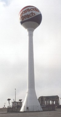
Water tower at Pensacola Beach. |
Pensacola Beach Nourishment Project Dale H. Easley May 21,
2003
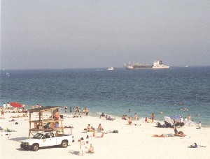
Over Easter break, my family and I went to Pensacola Beach, FL. We like to stay
in an old hotel right on the beach. However, after being there a little while,
it occurred to us that it certainly seemed farther to the ocean than last year.
No doubt we're getting older, but age alone seemed an unlikely explanation. In
fact, our previous experience indicated that each year the ocean got closer to
the hotel, not farther away!
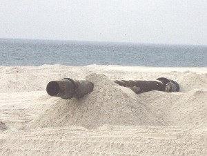
Dredge near beach. |
Early the next morning, I awakened before the kids for a walk down the beach. I
like to make some coffee, go to the nearby pier, and stroll out to watch the
waves and see if the fish are biting. As I strolled out on the pier and looked
east, I saw a large boat close to shore, unlike any I'd seen near the beach
before. Nearby on the beach were large metal pipes. Bulldozers rumbled over
where tourists usually sunbathed. As I asked around, I discovered that Pensacola
Beach was undergoing a major beach renourishment program. Hurricanes Erin and
Opal in 1995, Georges in 1998, and Tropical Storms Hanna, Isidore, and Lilli in
2002 all eroded the beach, so much so that the State of Florida designated
Pensacola Beach as a critically eroded shoreline. Approximately $20 million were
now being spent to widen an 8.5 mile stretch of the beach.
Seeding of the beach with new sand. |
Besides erosion due to storms, beach loss occurs due to natural subsidence, sea
level rise, and longshore currents. The beaches of the northern Gulf of Mexico
lie upon thick packets of sediment deposited throughout millions of years of
streamflow. These sediments continue to consolidate and dewater, reducing their
volume and leading to subsidence. Not surprisingly, the sediments that subside
the most are the newest geologically, such as nearshore barrier islands,
including Santa Rosa Island where Pensacola Beach is located (Click
for map.). Many of these sediments have been deposited and reworked since
the last ice age, about 18,000 years ago, a short time ago geologically. It is
natural for coastal sediments to move. In the northern Gulf of Mexico, the
predominant current is east to west, causing sediments to migrate in a westward
direction. Offshore islands tend to erode on their eastern end and build on
their westward end. In addition to these currents, sea level rise has modified
coastlines. Islands become more frequently overtopped by water during storms,
leading to more erosion. Old shorelines become submerged. A submerged shoreline
is the source of sand for the restoration project at Pensacola Beach. Sand from
about 65 feet water depth is used to replace sand lost to erosion. The sand was
chosen because of its location and to approximate the color and physical
characteristics of sand already present on the beach. A barge is used to churn
up the sand which is mixed with water so as to create a slurry. That slurry is
pumped through large pipes onto the beach. Once there, bulldozers place and
smooth the sand, creating new beach several tens of feet into the ocean.
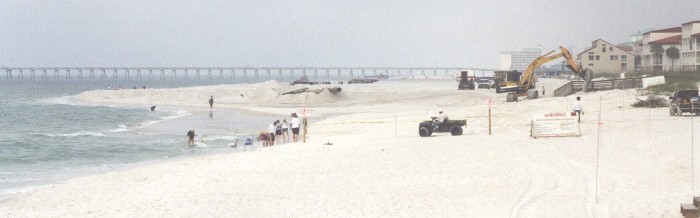
Note width of new beach being constructed. Pier is in background. |
Protecting coastal zones is crucial to us here in Louisiana. Barrier islands,
similar to Santa Rosa Island, and coastal wetlands protect us from hurricanes.
The Louisiana coast is also incredibly rich in resources and culture. We have
the US's busiest port (by volume), more offshore oil wells than Texas, the
second greatest concentration in the world of petrochemical plants, a huge
seafood industry, and cities that tourists flock to. In our efforts to protect
coastal Louisiana, we must seek to understand the successes and failures of
efforts throughout the U.S. As the Pensacola project progresses and our family
beach vacations continue, I'll try to add new photos and observations to this
site.
Additional Reading:
|