The East African Rift Valley
By Dale Easley June 13th, 2003
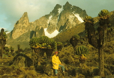
On Mt Kenya. |
When I finished Guilford College with an undergraduate degree in mathematics, I
had no idea what I wanted to do except travel. So I applied for a two-year
volunteer position teaching math in the highlands of Kenya at a boarding school.
The highlands are heavily farmed because of the climate---not too hot because of
the altitude but not too cold because of the latitude. Within sight of the
school is Mt Kenya, the second highest peak in Africa. It is snowcapped despite
being almost directly on the equator. A bit further west is the East African
Rift Valley, an arm of the best example in the today's world of a triple
junction.
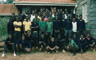
With my students. |
Classes met for three months at a time with a month's vacation between terms.
During my school breaks, I travelled around Kenya, going on safaris, visiting
lakes and beaches, and seeing the cities. Where I lived at an elevation of 6000
feet, malaria was uncommon, but I caught it during my first vacation when I went
on a safari that took me to lower elevations. Among other sites, I got to see
the Rift Valley. The highlands of Kenya are cut down the middle by a rift that
drops the elevation by thousands of feet. From lush damp forests, one descends
rapidly to the dry hot valley floor. A string of lakes along the valley represents the
terminous of streams off the highlands----water flows in but doesn't flow out.
Instead it evaporates. Some of the lakes have, over thousands of years, become
very high in dissolved minerals, high enough that evaporites are deposited in
some of the lakes in sufficient quantities to be mined.
From the USGS |
The formation of the Rift Valley, along with the Red Sea and the Gulf of Aden,
is an example of the process of continental rifting. In this case, the Middle
East Peninsula is being separated from Africa. When a continent rifts, the
crust first bulges, explaining the elevations in highlands and north through
Ethiopia. We geologists believe the bulge is due to the rise of hot magma from
the mantle. The uplift leads to the formation of three-way split, with the
central part of each arm of the split collapsing downward to form a graben. Two
of the arms of that split continue to grow, in this case the Red Sea and the
Gulf of Aden. As they continue to separate, mantle material flows out, forming
new oceanic crust and the beginning of a new ocean. The third part of the split,
the East African Rift, if it continues to grow, will turn East Africa into an
island in the Indian Ocean.
Along the floor of the Rift Valley, I saw the evidence of hot rock still near
the surface. As the rift forms, fractures develop through which magma can move
upwards. Mt Longonot (photo below) is a recent volcano on the valley floor.
Along the flanks of the valley can be seen evidence of old lava flows. At Lake
Bogoria are natural hot springs [photo].
Ground water is heated by the hot rock near the surface and comes steaming to
the surface, similar to (though less dramatic than) Old Faithful at Yellowstone,
a continental hot spot.
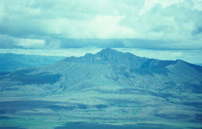
Mt Longognot, Kenya |
One of the reasons for us in New Orleans to study the East African Rift is to
better understand the way the Gulf of Mexico formed. Millions of years ago,
Africa, Eurasian and the Americas were joined together. Uplift began to occur
near where today's GoM is located. Multiple three-way splits formed and grew to
form the Gulf. The failed third arm of one passes beneath what is now the
Mississippi River. Though earthquakes are rare in the interior of continents,
this weak spot accounts for the presence of the New Madrid earthquake zone
2. In the early 1800s, a series of earthquakes occurred at New
Madrid so powerful that they rang the churchbells in Boston, created new lakes
and land, and caused the Mississippi River to briefly flow backwards in places.
Back then, few people were living the area, but such an earthquake now could be
devastating. It's just a matter of time till it happens.
1Multiple
links on the East African Rift Valley
2Earthquakes
in the Mississippi River Valley |
![[photo]](HotSprings_RiftValley.jpg)